
Ever since I visited Cyprus for the second time in early 2020 and drove around the still divided country, I have had a strong urge to document the shocking things I saw and heard along the way.
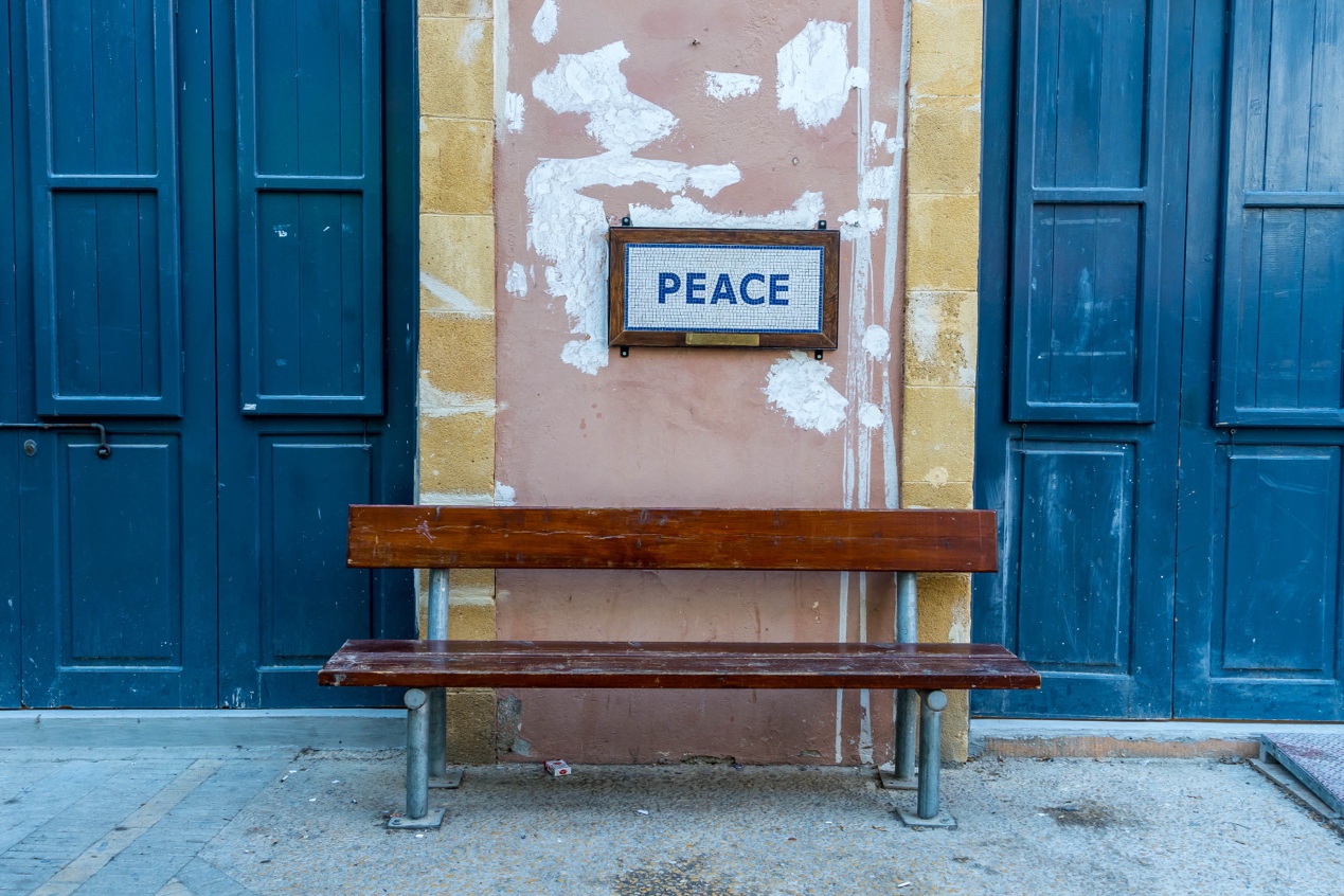
Of all our needs and desires, ‘peace’ will always be the most cherished thing.
The article was first published in Lonely Planet China magazine, Issue 03/2022.
This English version was translated from the Chinese original with DeepL, with the manual correction of some obvious mistranslations. I apologize for any mistakes made by this AI translation tool.
This is the first part of the article. Click here to read the second part.
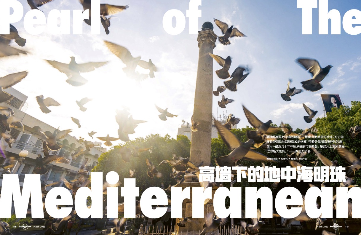
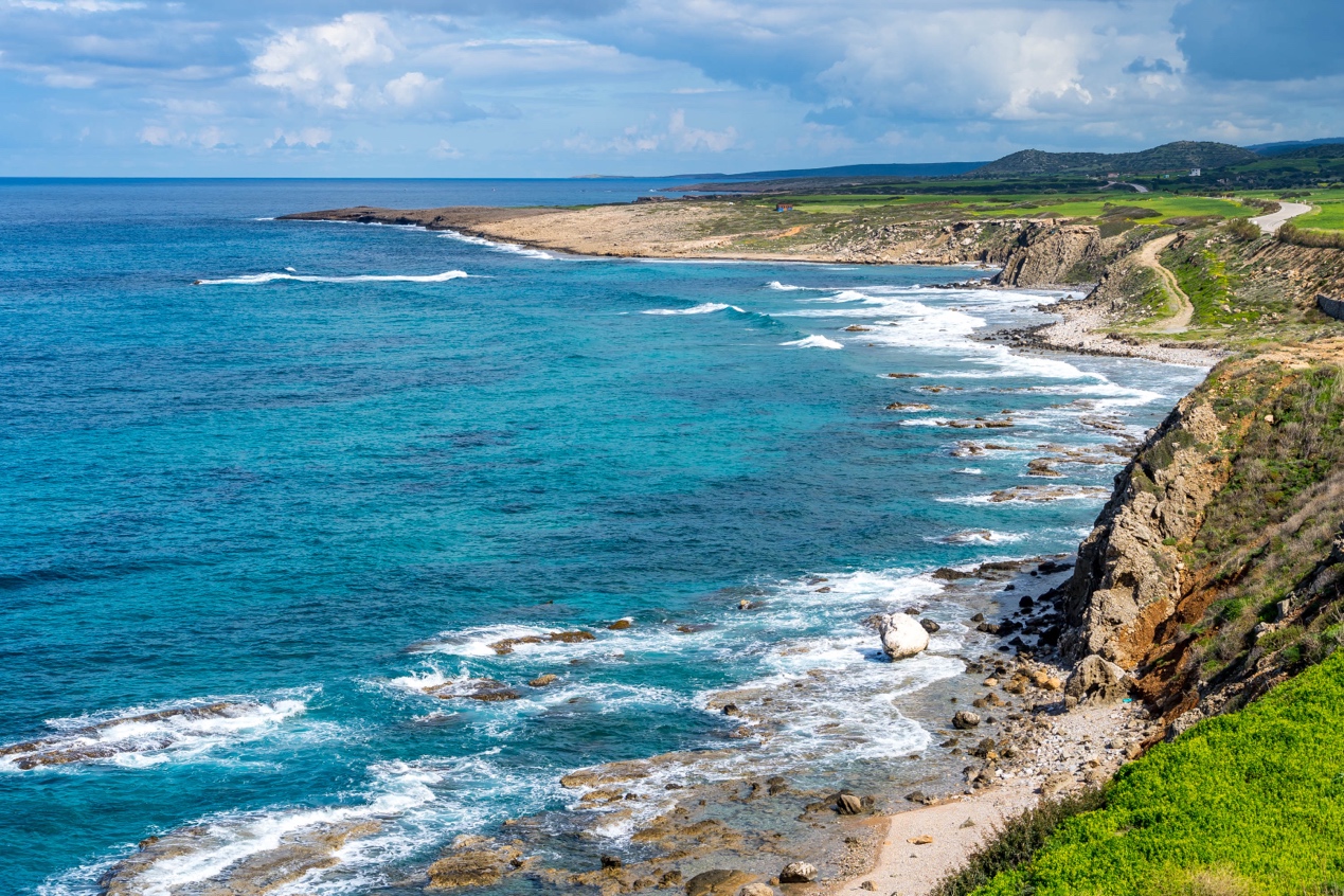
Cyprus is a pearl in the Mediterranean, a pearl of rare beauty, which, however, bears the wound of barbed wire, the pain of a wall that divides it.……The greatest wound suffered by this land has been the terrible laceration it has endured in recent decades.
Pope Francis, December 2, 2021
I went to Cyprus for the first time in 2016.
The immigration officer at Ercan airport was stamping the passengers in the queue like a machine on an assembly line, until he noticed the Chinese passport I handed him and started to hold it in his hand and look at it.
“Chinese? Tourist?” He looked up at me, who was carrying a large bag.
I wasn’t afraid of him flipping through his passport; after all, I’ve never heard of anyone being denied entry in a place that is visa-free for tourists from almost all over the world. But from the curious look on his face, he probably had never seen a tourist from the most populous country in the world.
Seal affixed. “Welcome, my friend!” And so I entered this “non-existent” country.
In 2016, the northern side of the island, where Erjan airport is located, was still the only place on the entire Mediterranean coast where Chinese people were allowed to enter visa-free. It’s not that other Chinese tourists didn’t want to come here to enjoy the sea and the beach, but they didn’t even know it existed – in all the textbooks and maps published in the country, there was only one country on the island, called the “Republic of Cyprus”. As a member of the European Union that will soon join the Schengen area, there is a visa policy similar to that of the Schengen area, and naturally there is no visa-free access for Chinese people.
It is not that China is hiding anything; in fact, if you open the textbooks and official maps of any country in the world (except Turkey), you will find no other country on the island of Cyprus as well. Yet a regime calling itself the “Turkish Republic of Northern Cyprus (TRNC)” in fact occupies almost half of the northern side of the island, with a currency, language, visa policy and even cell phone reception that is very different from the southern side. As the name implies, only one country in the world recognizes it, and that is its “mother country”, Turkey.
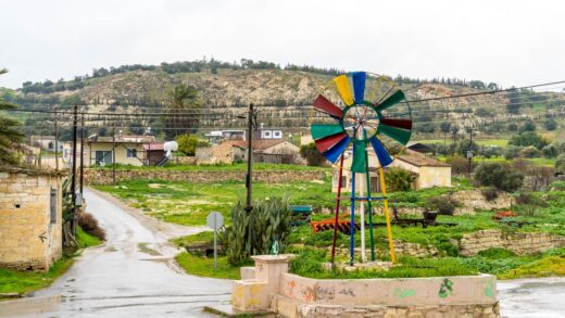
Nicosia, the world’s last divided capital
Erjan Airport is the only civilian airport in Northern Cyprus and is located only half an hour from the capital Nicosia (“Lefkoşa” in Turkish). It is only half an hour away. Having just finished a trip to Turkey, it was hard to feel like I was in a new country: the street signs still read Turkish, the Turkish lira still circulates, and even the Turkish “red background with white star and crescent” flag still flies here, alongside it is the “red star and crescent” flag of Northern Cyprus, which seems to be a simple reversal of the colours of the Turkish flag.
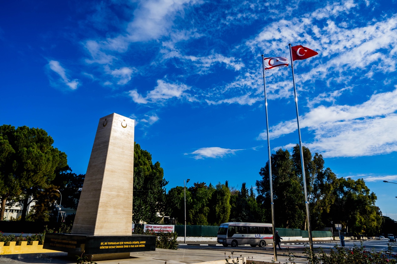
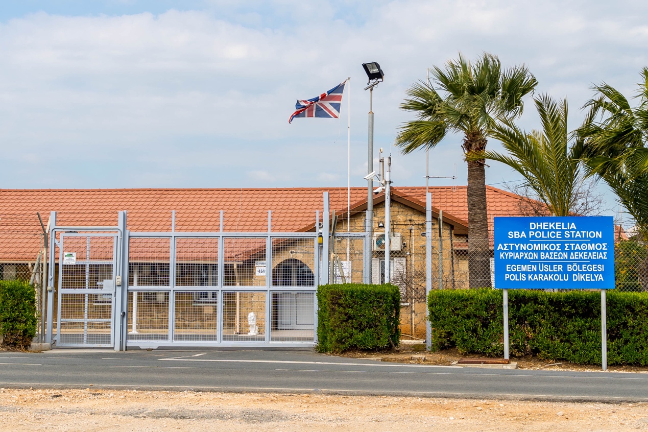
There are only about two differences from Turkey: one is that all vehicles have switched to the left side of the road, and the other is that Turkish mobile phone cards have lost their signal – the former a mark of more than 80 years of British colonial rule on the island, and the latter a breathless declaration of “independence”. “.
I found free accommodation from the Couchsurfing website, hosted by Filat, a Turkish man who is studying at university here. He was renting a house on the outskirts of Nicosia, and his roommate and classmate, Kadir, were both Kurds from southeastern Turkey. Both are English majors, but while Filat, a junior, is already conversing more fluently, Kadir, who has been here less than a semester, has to rely on Filat as a translator.
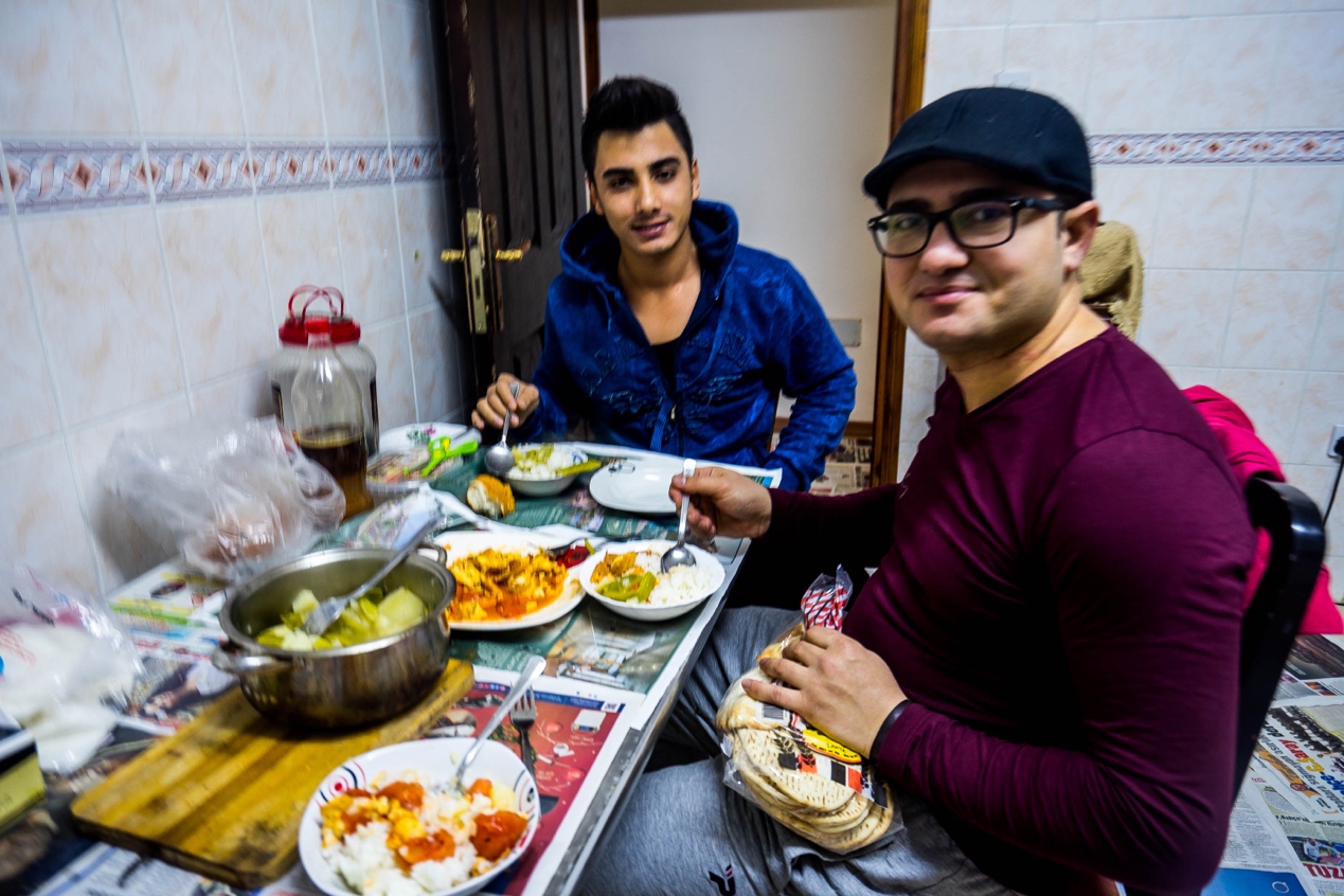
Filat told me bluntly why he came here: “My grades weren’t good enough for university in Turkey, but the admissions line for schools in Northern Cyprus was lower.” Promoted under the banner of British education, North Cyprus now has a thriving education industry that attracts students from Turkey and around the world, from English majors to English-taught courses, thanks to relatively low tuition fees and low entry barriers.
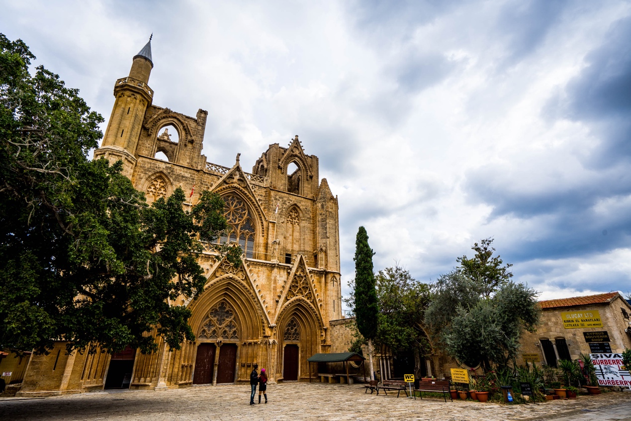
However, my trip was not a study of local education, I came for the last divided capital on earth. The Turkish community occupies only the northern half of Nicosia. The southern half of the city is ruled by the Republic of Cyprus, which is predominantly Greek.
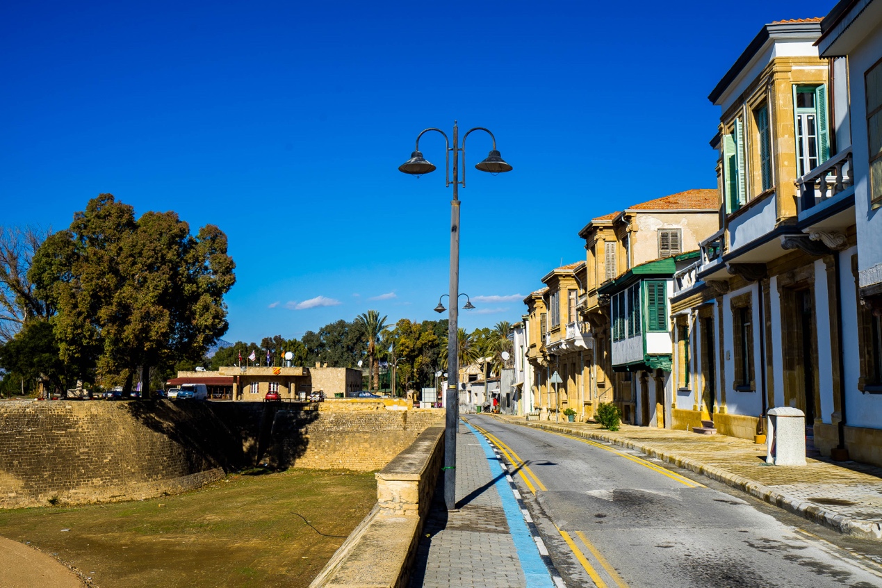
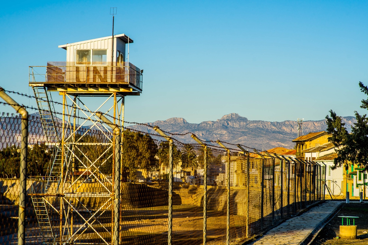
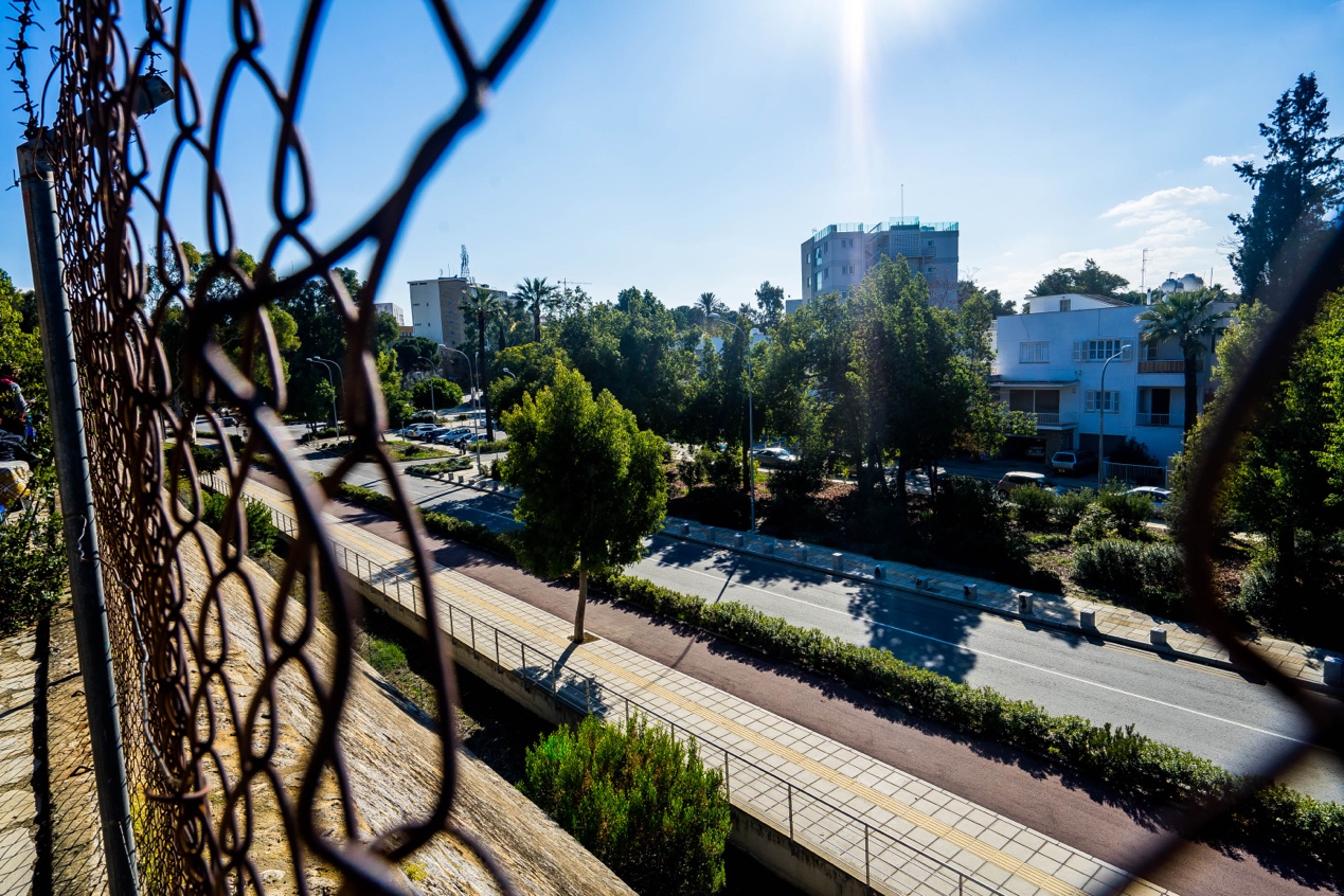
A high wall separates the territories of two peoples, rather it is a long, narrow, enclosed area manned by United Nations troops running east to west across the island, known as the “United Nations buffer zone in Cyprus”, commonly known as the Green Line. In Nicosia, the Green Line runs right through the centre of the distinctive circular old town left over from Venetian rule, which, as seen on the map, looks like a birthday cake cut precisely in half.
“I’ve never been south because I couldn’t cross the Line.” Filat said to me.
The origin of the Green Line begins in 1960, when the whole island of Cyprus gained independence from British colonization. The fledgling state, composed of about 80 per cent Greek and 20 per cent Turkish, came up with a “two-headed, three-master system of government” with compromise written all over it: the president and vice president were elected by the Greek and Turkish communities respectively, and the cabinet was divided 7:3. At the same time, Greece and Turkey, as the respective “sovereign states” of the two communities, were allowed to station their troops on the island in a ratio of 3:2, while the British, in order to maintain their influence in the Mediterranean and even in the Suez Canal, still kept a large separate sovereign military base area.
For centuries before, the two communities had lived on the island in mixed harmony. They lived in two neighbouring communities, or even in the same village. To the north and south of the island, the bells of the Greek Orthodox church and the mosques of the Turkish mosque echoed daily.
Since the end of British colonial rule in the 1950s, however, the two peoples have been embroiled in a long-standing feud, instigated by their respective sovereign powers. A small group of radicals from the demographically dominant Greek community formed the “EOKA” (National Organization of Cypriot Struggle) and pushed for the annexation of the whole island to Greece by means of violent and even terrorist attacks. Some members of the minority Turkish community, using the deterrent effect of the Turkish garrison, also chanted the slogan “Taksim” (meaning “partition”) in an effort to carve out an exclusively Turkish area after the island’s independence.
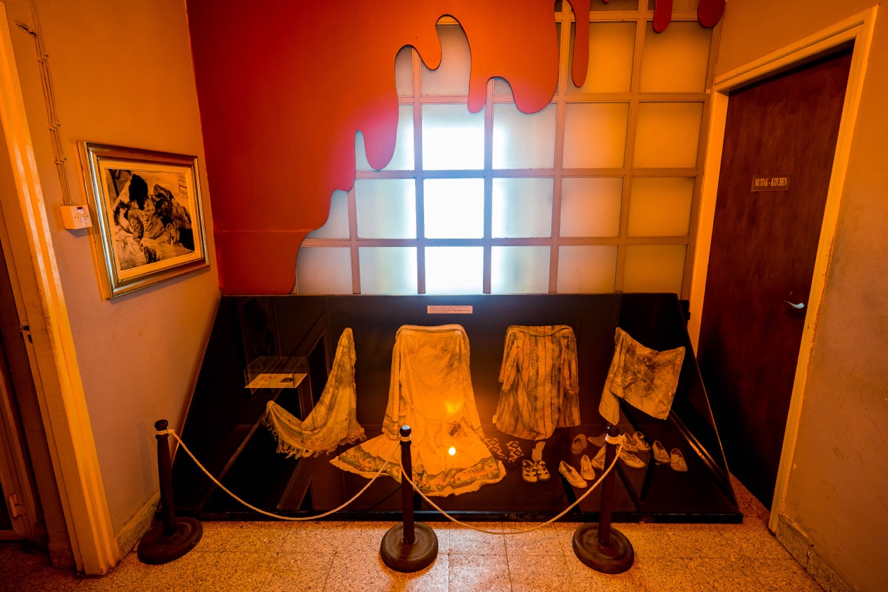
I left Firat’s house and walked towards the old town of Nicosia. Halfway down the road was a nondescript bungalow with a puzzling door sign: the Museum of Barbarism.
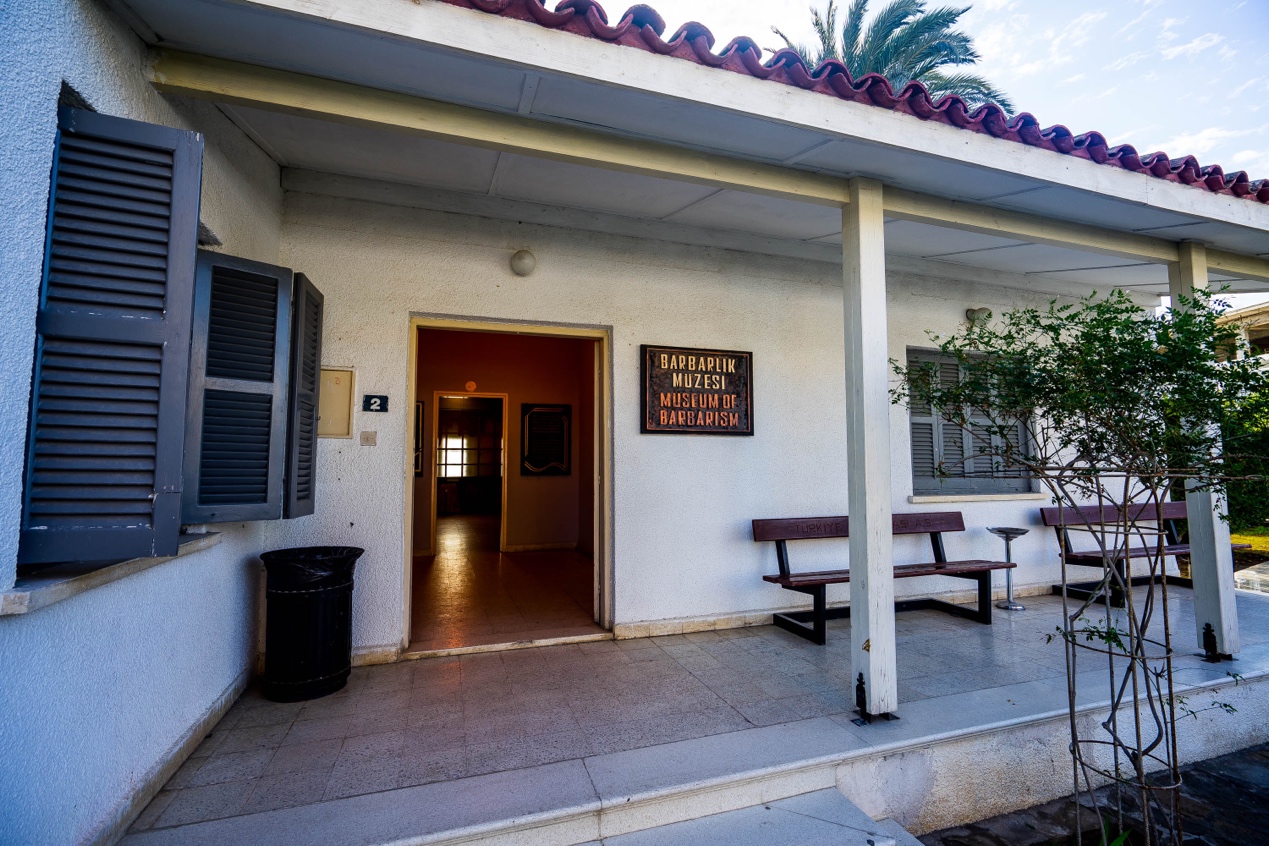
From the layout, it was clear that the house had been a home, with black and white photographs on the unadorned walls: a middle-aged man with a bullet through his head, three boys and a young woman lying in a pool of blood in a bathtub …… full of such chilling scenes. When I took a closer look at the empty house, I realized that the door, the furniture, and even the wall next to the bathtub were covered with tiny bullet holes, and I was shocked to feel a chill coming from behind.
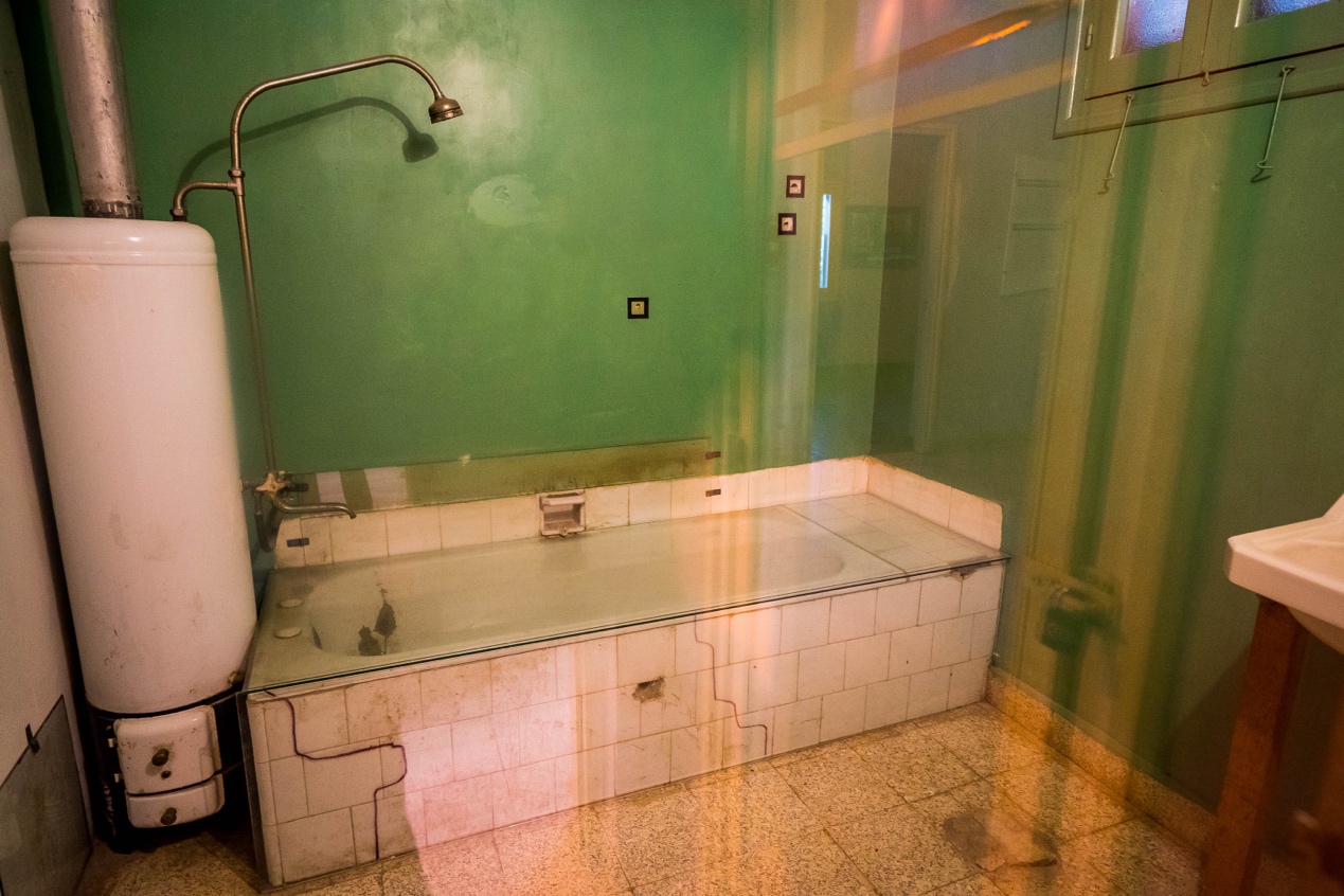
According to the description, the house belonged to Nihat İlhan, a military doctor in the Turkish Forces in Cyprus, and around Christmas 1963, the first major post-independence clashes between the two communities erupted across the island. İlhan’s wife and three children were among the more than 500 civilians from both communities who died in what was later dubbed “Bloody Christmas”. On that unholy Christmas Eve (24 December), Greek militants stormed their home and shot dead four people hiding in the bathroom, while Ilhan himself escaped death because he was on duty that day.
After the conflict, the British commander in charge of keeping the peace in Cyprus drew a ceasefire line in green pencil on a map of Nicosia separating the two occupied areas, which was the earliest precursor of the Green Line. In his book Journey Into Cyprus, British travel writer Colin Thubron records that when he visited Nicosia in 1972, he saw the Green Line as a mere roadblock, where everyone could move freely despite being guarded by the UN garrison. The Green Line was still only a few roadblocks, and despite being guarded by the United Nations garrison, everyone could move freely between them.
In 1974, a coup d’état staged by ethnic Greek radicals to annex Cyprus to Greece shattered the short-lived and fragile Peace. Turkey intervened and within days the whole island, including Nicosia, was cut in half. Since then, no one has been able to cross freely between the north and south sides of the island, and the Green Line has become a real “dead line”, like the well-known Berlin Wall or the demilitarized zone (DMZ) on the Korean peninsula.
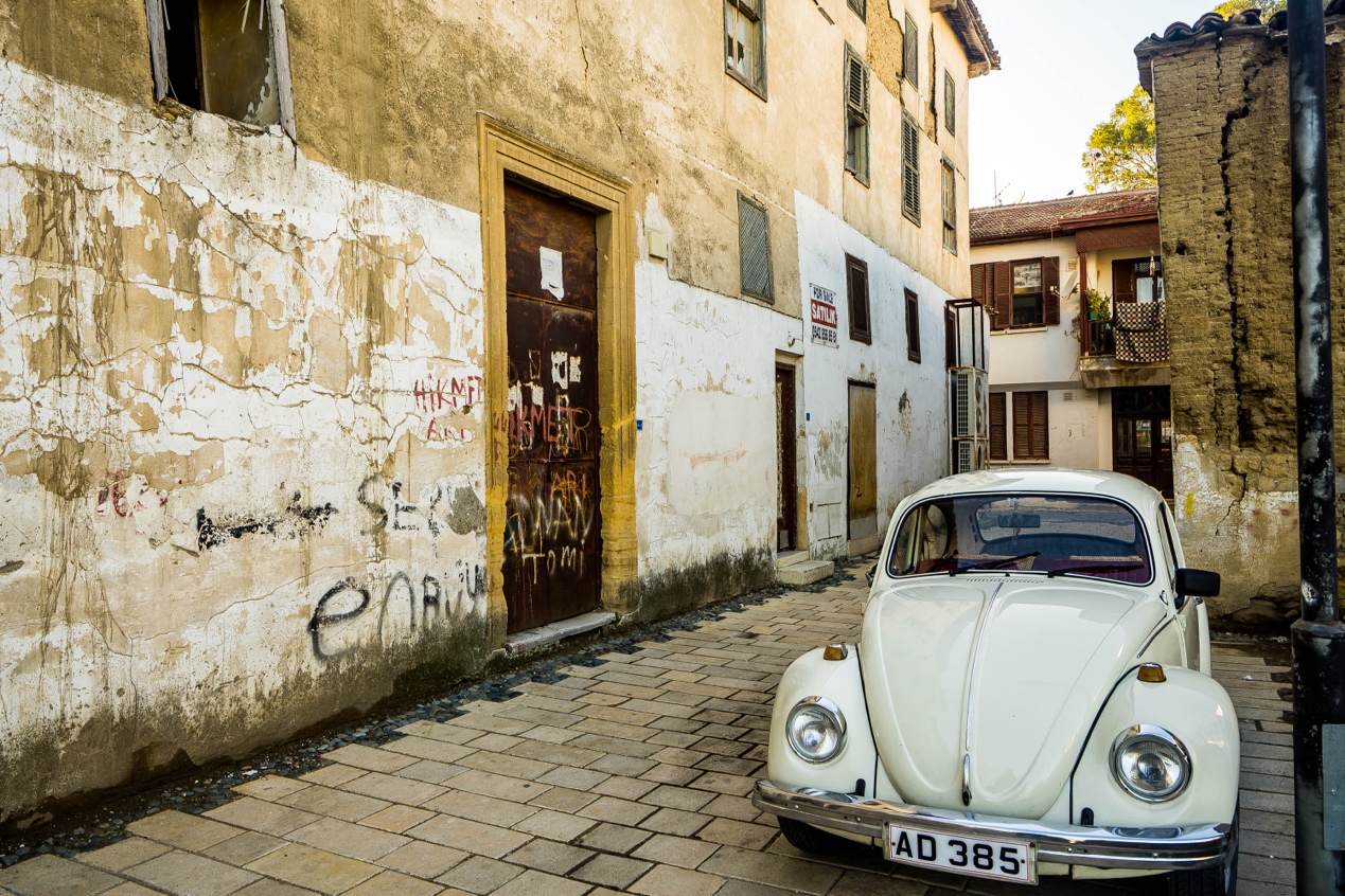
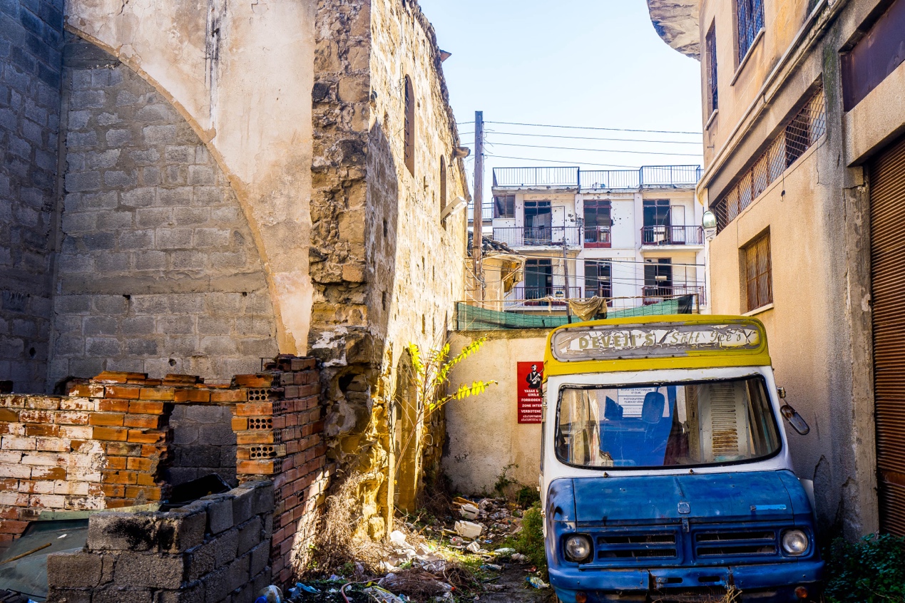
The old town of Nicosia is small, with a decadent mix of Southern Europe, the Middle East and the Ottomans, typical of the Levant in the Eastern Mediterranean. Like the Berlin Wall, Nicosia’s north-south divide was artificially created in a short period of time, and the citizens who have lived here for generations never saw this day coming. So when I followed the map and found the Line through the city, I saw ordinary houses enclosed in the north and south walls. In terms of building form, there was no difference between the inside and outside of the wall, but the buildings enclosed in the wall had broken windows and peeling walls, as if they were permanently sealed in time from the beginning of the war.
“I lived on the other side of the wall when I was a kid.” An elderly gentleman twirled his beard and spoke slowly to me. He was sitting on the street corner drinking tea, his typical Turkish face tanned from years of living under the Mediterranean sun, yet he still had the mannerisms of an old-time English gentleman in his hands.
“One of my friends lives in this building in the wall, and another lives in that direction.” He pointed off into the distance, his words a little sobbing, “They were both Greek, but we were particularly good friends at the time.”
“And have you seen them since?” I asked.
“Of course.” He let out a hearty laugh, “From the war in 1974, the pass didn’t reopen until 2003, and we didn’t see each other again until then, we barely recognized each other.”
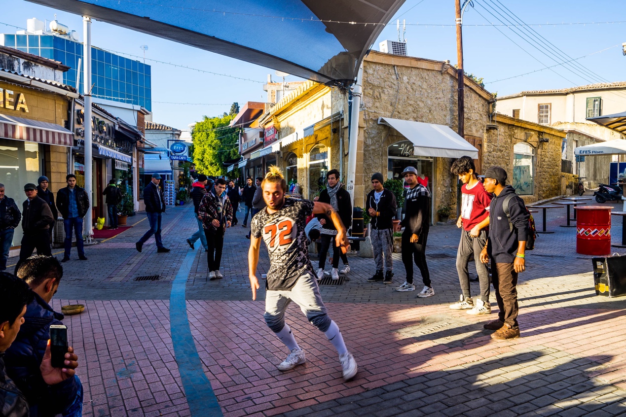
When the old man said “crossing”, he was referring to the crossing point across the Green Line that connects north and south, and there are three of them in Nicosia today, the one on Ledra Street being the only one in the old town. I arrived at the northern entrance to the crossing, where several young people were using the empty space in front of it to dance in the street. There was a constant flow of people crossing the border, most without any luggage, simply handing their papers to the police at the booth and walking across the border without looking back, with no sense of getting abroad.
With the reopening of the Green Line in 2003, and in particular with the accession of (South) Cyprus to the European Union in 2004, the original inhabitants of the North side of the island, who lived there before the division in 1974, were also granted South side citizenship and EU citizenship; and the North Cyprus authorities have generously granted free access to all from the South side, making the crossing of the once inaccessible Green Line a no-brainer for locals.
But for foreigners like Filat and me, it is completely different. The South side considers all foreigners entering the island from North side as illegal. So people other than EU citizens cannot enter from the North and then enter the South, even if they have a visa recognized by the South.
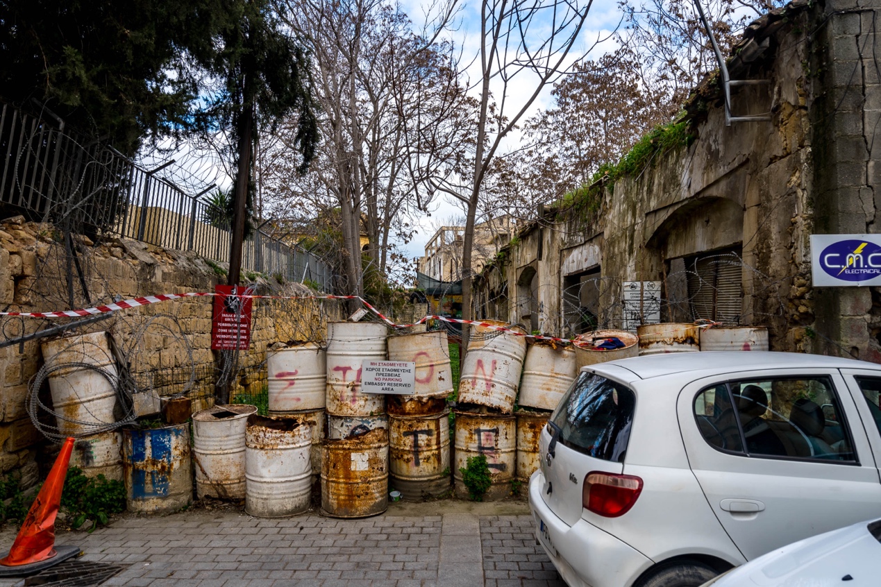
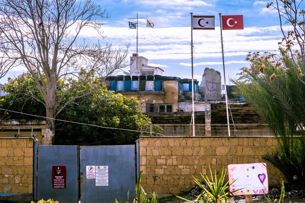
The Green Line is more than 7 km wide at its widest point, encompassing the former Nicosia airport and several villages, and only 3.3 m narrow at its narrowest point, next to the Sınır Parkı on the western side of the old city. The park is built on a star-shaped prismatic fortress jutting out from the old city walls, and it is somewhat ironic that this solid fortress, built by the Venetians to defend against the Ottoman Turks, is now a place where the Turks assert their “sovereignty” from above.
The Turkish flag and the Northern Cyprus flag are flying high on the flagpole, while the Greek and Cypriot flags are flying on opposite sides, as if in a competition. The two are separated only by a sparse barbed wire fence. You can see (and hear) the cars and pedestrians on the opposite side of the road, and even the sound of their conversations. Standing here, one gets a strong sense of unreality, as if the barbed wire fence is not separating two regimes that have been at war for more than 40 years, but just an ordinary city park inside and outside.
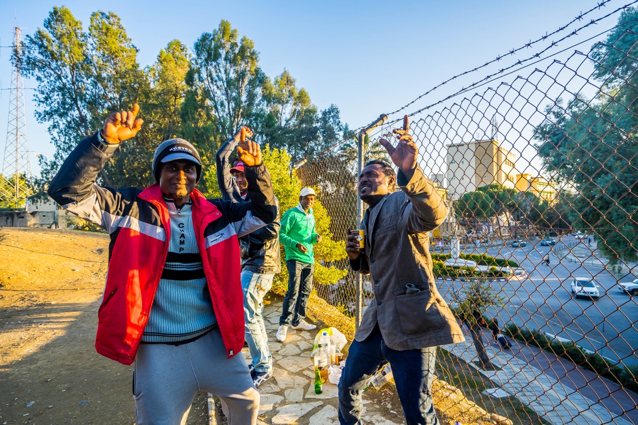
Several young South Asian-looking men are here dancing to the song. The song comes from the bar across the barbed wire fence, “This is our country’s music!” The young men dancing shouted at me, shaking the bottles in their hands with pride. They were labourers from Sri Lanka and this was their day off. Again, they couldn’t go south, so they had to go to the barbed wire fence like me to get a feel for the opposite side.
Famagusta: the search for the Sunrise Hotel
For Aphroditi, even now, there was only one thing that preoccupied her. Not if or when they would see the arrival of Greeks, Americans or British soldiers, but if or when she would see the man she loved. The rest had no meaning.
The Sunrise by Victoria Hislop
The minibus dropped me off in front of the old city gates of Famagusta, a city on the east coast of Cyprus. The day was overcast as I crossed the thick stone bridge over the dried up moat into the city.
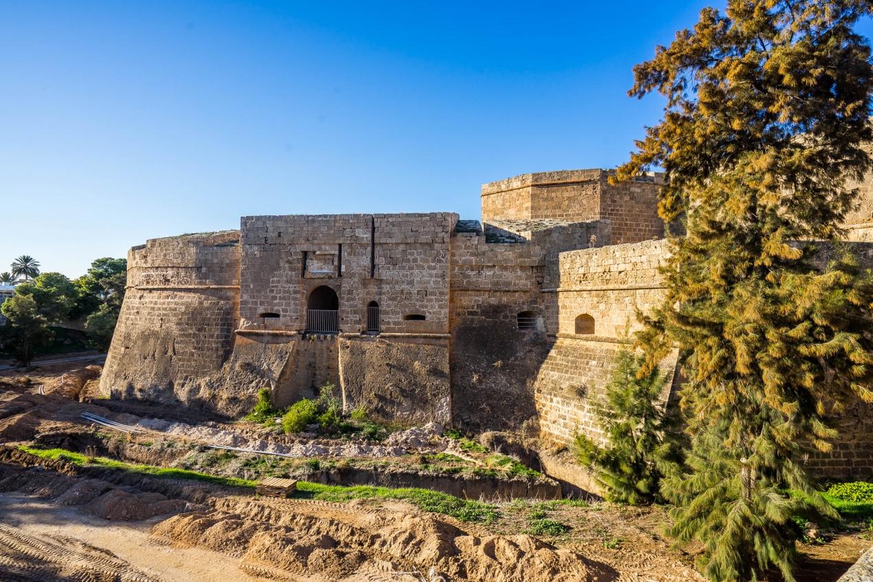
The magnificent city, which still breathes majesty today, was founded in the late 12th century during the Rousignan dynasty under the Franks. Over the next 800 years, it changed hands several times between the Genoese, Venetians, Ottoman Turks and the British. Shakespeare’s famous tragedy Othello, set in the coastal castle next to the old town, was written at the beginning of the 17th century, when the Venetians and Turks were fighting over it.
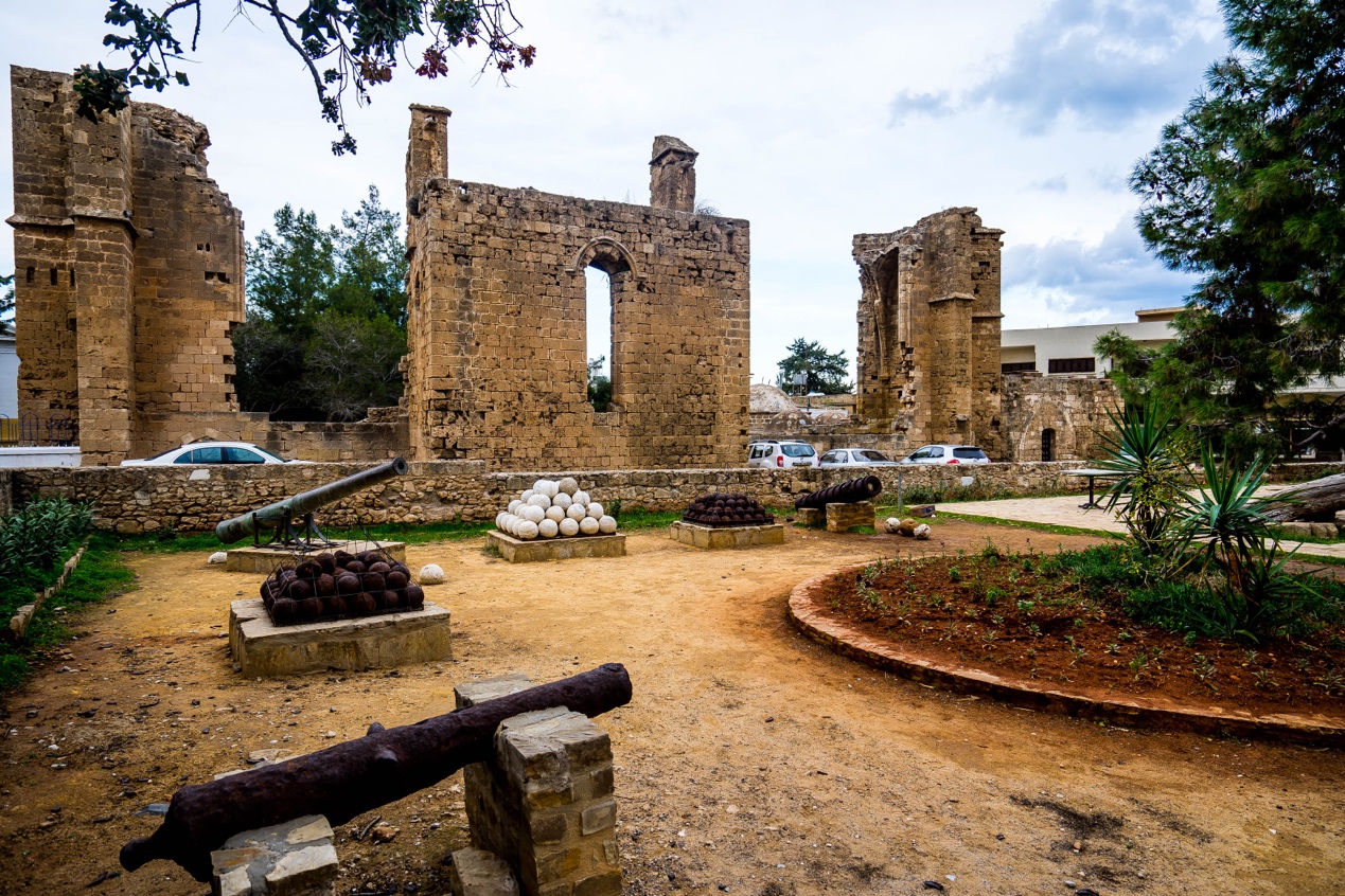
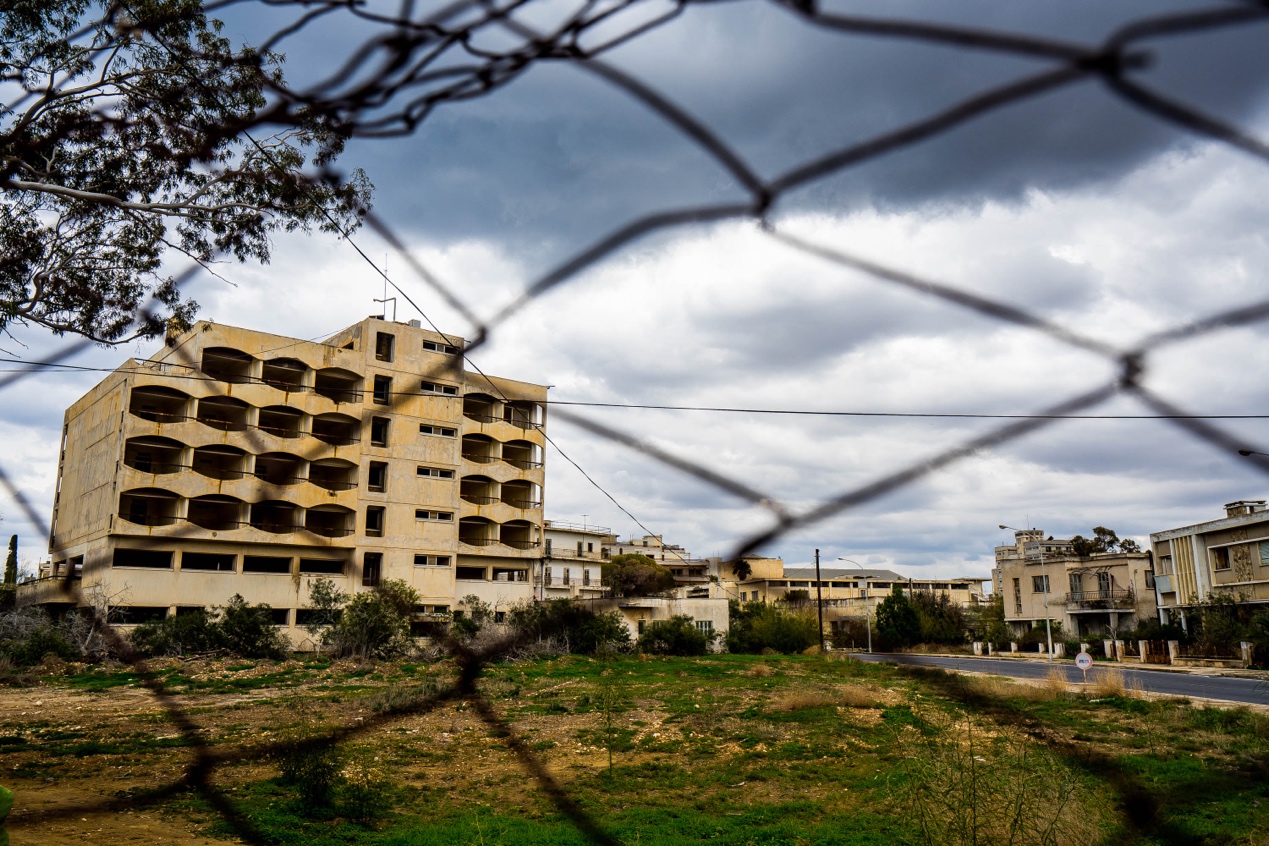
Walking through the Old Town, the intricate winding alleyways, the Gothic churches that have been converted into mosques, and the small restaurants along the roads that are futilely inviting tourists, all the signs seem to indicate that this is just a much colder “Little Nicosia”. The Old Town has been an ethnic Turkish settlement since the Ottomans took it over in the 16th century. The Greeks, on the other hand, lived mostly in the new town of Varosha, south of the old town, for centuries.
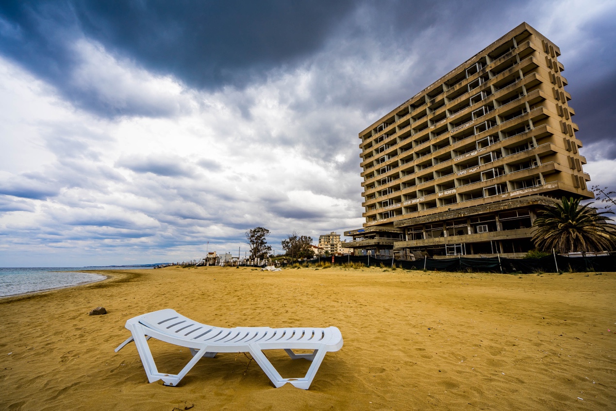
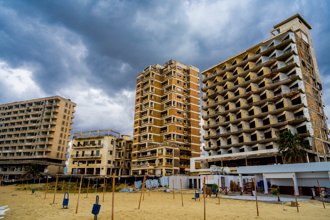
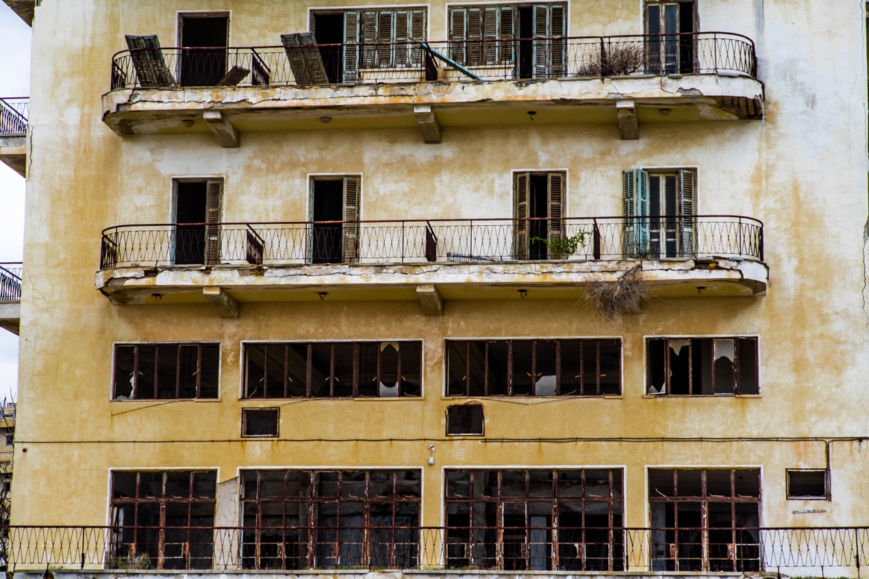
From the old town, as you exit the city to the south, you can see from afar the jagged concrete buildings of the new town, stretching along the coast in a spectacular, almost perfect arc. However, only when you get close can you see that every window on the upper floors has lost its glass, leaving a blackened and broken hole, and the long-standing smell of decay emanates outward; the long-rotten window frames sway in the wind, as if the whole building will collapse in the next moment. In stark contrast, the front of the building is a soft, long, high-quality beach.
A thought occurred to me: which building in this whole row of ruins looked most like the Sunrise Hotel?
The Sunrise is a full-length narrative novel by British author Victoria Hislop. The fictional hotel of the same name in the book was completed shortly before the Civil War in 1974. As the most luxurious hotel on this beach, it was a place of lights and nightly entertainment. The hotel is fictional, but the hot resort of Varosha is a real thing.
In an old photo taken back then right where I was standing, this beach was packed with hot, dressed vacationers. And the row of buildings behind them, upon closer inspection, were indeed the same ones I was looking at. Only then they were freshly painted and glistening.
“FAMAGUSTA WAS GOLDEN.” So writes the author in the first sentence of the entire book.
As a novel depicting war, the author does not focus too much on the tragedy of the battle, but always portrays the life and love of the main character Aphrodite, who is completely rewritten by the war. Before the war, she was wife of the owner of the highly regarded Sunrise Hotel, with an enviable family and extravagant life.
There seems to be no reason why this should change until the war comes unexpectedly – holidaymakers and even the entire city flee in a hurry almost overnight, turning the Turkish-occupied Varosha into a completely empty city. Aphrodite, who had fled Varosha in search of her unaccounted-for lover, returns to the city after a long and arduous bribe. Here, however, she not only fails to find her lover, but instead suffers humiliation ……
The vast majority of us have never experienced war, so whenever we hear or read accounts of it, the scenes we imagine are mostly grand and abstract. But those who have actually been there, because of the breakdown in communication, may not know the whole picture of the war. The only thing they can really feel is their own situation at the moment.
A white plastic lounger was left on the beach, and perhaps now in the summer there are still a few tourists on the beach, which is not a restricted area. But at the moment, with the giant ruins behind it, the lone lounger certainly makes the beach look even more miserable.
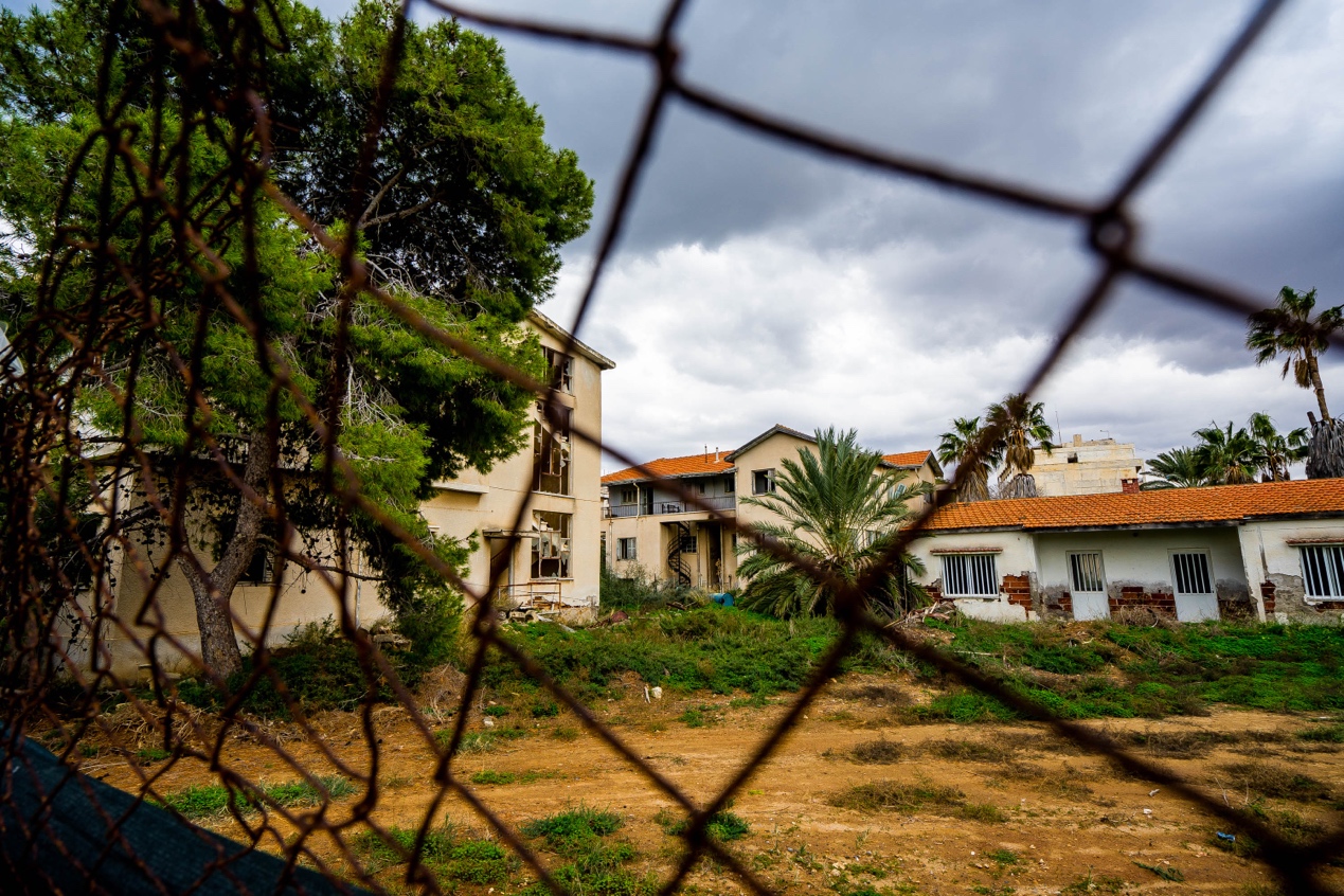
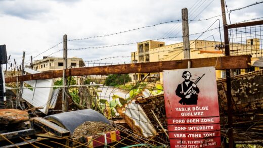
At the end of the beach is a rusty barbed wire fence with a bright red warning sign depicting a heavily armed Turkish GI warning in four languages of a “no-go zone.” Since the 1974 war, and up until 2016, when I visited, no civilians have been allowed to enter the Turkish military-occupied city of Varosha, even the original residents who legally own property in the city.
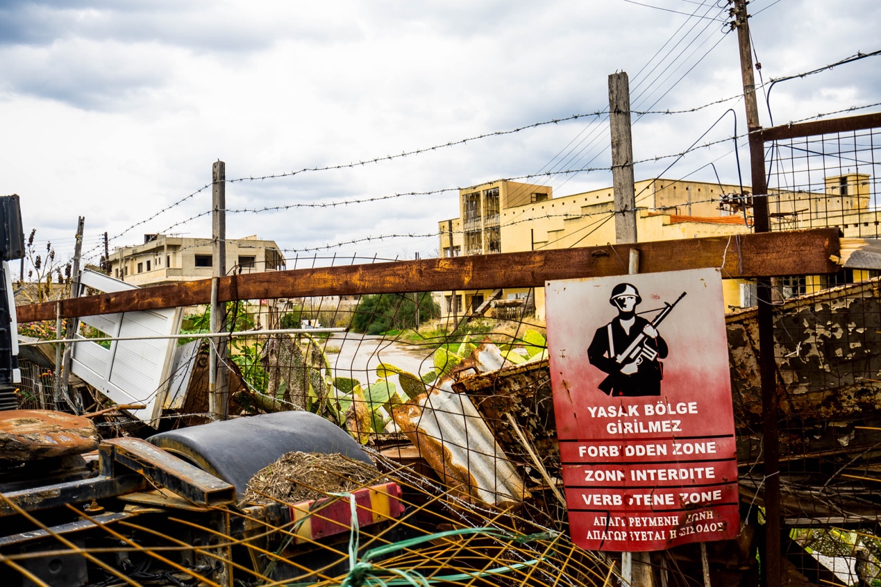
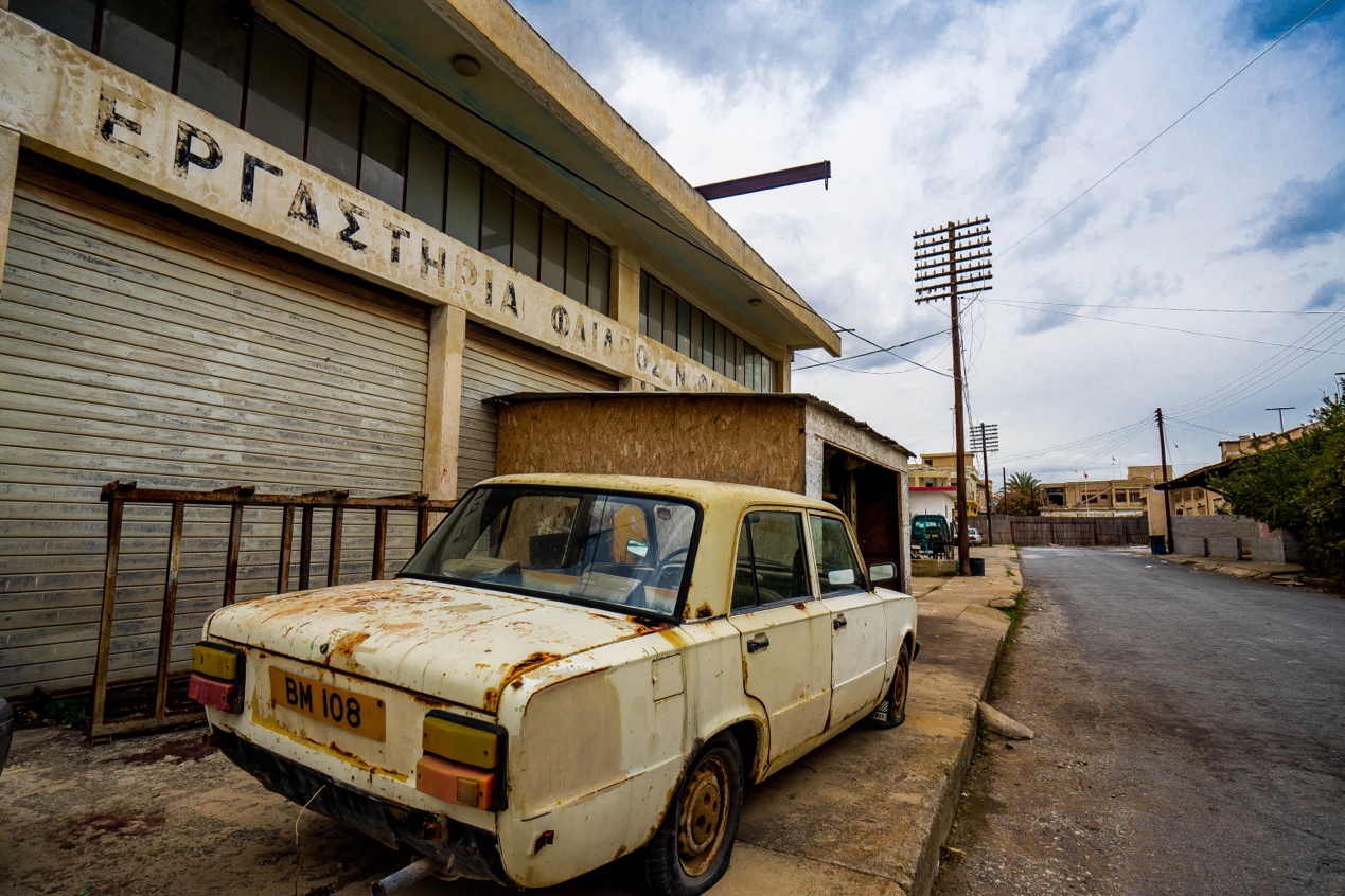
The entire city is surrounded by a dense barbed wire fence, which has made it a long-standing contestant in the major online ghost town competitions. In fact, you don’t even have to enter it, just walk around the fence and you’ll see a lot of sad scenes that are hard to imagine: faded Greek signs in front of shops; 1970s-style limousines with rusty iron shells ……
I paced the beach, the long-untrodden sand was marked with deep or shallow marks, but as the waves passed by, the marks quickly disappeared without a trace. Behind every window in that row of once luxurious hotels, densely packed, there may have been a flesh-and-blood family living there at the moment the war broke out. Who remembers now what they actually went through during the brief battle that reduced Varosha to rubble?
Each of us, we are just small people in this big time.
1 Response
[…] This is the second part of the article. Click here to read the first part. […]